Friday, September 13, 2013

'Cooba Divin

Well I never made it out to the Long Path last weekend.  Chris was moving out so we spent Saturday moving stuff around the house and Sunday I had the worst hangover in the history of the world...stupid wine.  We did get to do go to the range and go diving so that made up for it.

This was the first time we went to the shooting range in Norwalk and it was great.  The target system is fully automated so you can specify how far away you want it and set it to turn at intervals, and move forward and back if you want a moving target.  I'm having trouble with the .380 - a piece actually fell off and I had to ask someone to help me.  The guys exact quote - "Well at least you didn't bring the gun out with you."  Do people do that?! Dear lord... Other than that it was fun.  Nice to get back out there.

We also made our debut into the cold water diving world.  We went to Rex on Thursday night to pick up our gear.  Up to this point we have never worn anything thicker than a 3mm wetsuit.  Now we're trying to get into a 7mm farmer john and and a 7mm shortie over it.  If you've ever seen "A Christmas Story", you know how I felt.  I was just walking around the dive shop saying 'I can't put my arms down...'.  Either way, got our gear, put it in the car, and went home for the night.

Ready to go!

 Get up next day, drive to Dutch Springs - which is in Bethlehem, PA about two hours away from where we live.  Issue No. 1 - We pay and go down to the parking lot to set up.  As I connect my regulator and turn on the air, it leaks.  A lot.  So we figure out it's the regulator itself, not an o-ring so we have to load up again, drive to a nearby dive shop and have them fix it.  Luckily it was just a leaky hose and didn't cost us any money.  Issue No. 2 - We get back, unload again and set up our gear.  We squeeze into our wetsuits and are now sweating profusely.  As I try to put my weight belt on, I realize the now 14mm of neoprene over my midsection makes me too fat for my goddam belt.  Luckily we have the old fashioned kind that they put the weights on for transport, so Mike gave me his and used the crappy one.  Issue No. 3 - As we're loading up the weight belts with the 24 lbs they told us to use at Rex, a "helpful" lady comes up and tells us she's on her 300th dive and this is way too much weight.  We only need like 12 lbs.  That's what she uses.  So we compromise on 16 lbs each.  Tank up.  Get all the way to the water.  Put on mask and fins and...can't get below the surface because we're too damn light.  Mike took everything off, went back to the car and got us both 8 more lbs.

FINALLY we get to descend and the visibility is awful.  Probably like 8 feet.  The guy who works there says it's normally much better but they've had a lot of rain lately.  Mike and I lost each other twice and had to come up to reconnect, and once we lost the 'attractions' and had to come up to figure out where the hell we were. When you look at the lake from the shore, you think 'Oh it's not that big - how hard can this be? But with such low viz and feeling like an overstuffed sausage - it was tougher than I though.

Dutch Springs Quarry

After coming up for lunch and refilling the tanks, we planned out our second dive.  This time we took the right weight, and had a definitive plan.  They say plan your dive and dive your plan and they're right.  The second dive went great.  We went down to 75' where the water temp was 53 degrees and stayed pretty warm.  The park has a whole bunch of planes, cars, trains, etc. at the bottom to look at so that was kind cool.  I saw some bass, bluegill, trout and koi.

Overall, it's a good place to try out new gear and test your resistance to cooler water.  There's not a ton to look at but it was really nice to get some mid season diving in.  It is a place where you have to know what you're doing, however.  There's no one to guide you, no boat captain to advise you.  YOU are responsible to make sure you stay safe.  As long as you keep that in mind, you're good to go.

Monday, September 9, 2013

P90X: Back to Basics

So anyone who has been around me during the past year and half knows that I've lost about 35 lbs total by doing P90X and Insanity.  And no I'm not a Beachbody coach.  The programs are solid and I hate the gym with a burning passion.  I'm not coordinated and suck at any type of cardio, so when the girl on the treadmill next to me looks like a glistening gazelle I tend to lose my motivation.

Either way, this past summer I ate a lot of delicious food and drank way too much beer and somehow managed to re-find about 15 of those lbs.  So now that I'm back in school and my pants are a bit *ahem* tight, I'm getting back on the wagon and starting up with P90X classic. I've done Classic, Insanity, X/Insanity hybrid, and a few weeks of X2.  P90X is by far my favorite.  It's well rounded and really gets the job done as long as you don't eat like crap.

I did day 1 today and holy moly am I out of shape.  I used to be able to do this with some semblance of competency but today kicked my ass.  Pull up are my arch nemesis and even with the pull up assist bands I can still only get up like 5.  All I kept thinking is 'I remember this being easier...'.

Fries bad! Shakes bad! Cheeseburgers bad! 


Day 1 is in the books, and hopefully by posting on here I'll actually stick to it and it won't end up like 10 or so P7X's that I've done in the past.

Tuesday, September 3, 2013

Section 8: 9.2 Miles

Alright well I finally filled in the holes and have officially hiked the entire "Hudson Palisades" section of the Long Path.  I really thought I'd be farther along by this time and this may be the 2013-14 project instead of just 2013, but I've really enjoyed doing it and am happy that I've gotten this far.

We brought the dog this time - he had a good time and thankfully didn't get any raw spots on his feet.  He also got to try out his new backpack.  It held two water bottles, some snacks, his leash, and his water bowl.  It also rub Riley raw like his last pack which I'm sure he was really grateful for.

Me and Riley at the top of High Knob in our matching gear.  

We hiked North to South, starting at a commuter lot.  The trail heads away from the lot on a short road walk.  Later, it cuts into the woods by a lake and the rest of the trail is off the road.  It's great that the Long Path organizers are working to move it off the roads as much as possible.  There are some cool buildings in Gonzaga Park that are left from when the property was a Jesuit retreat.

The stone wall around the retreat plus some cool old buildings.

Almost the whole trail is co-aligned with the Highlands Trail (light blue) and inside the park, it's also co-aligned with the Jessup Trail (yellow).  This makes for a lot of blazes, and the trail is not always marked with all of them, sometimes just yellow, so it's important to pay attention to where you're going.  The Highlands and Jessup trails split from the Long Path about 3 miles from the Woodbury trail head, so looking for that turn off is key.  The views from the top of High Knob are fantastic.  There are a whole bunch of overlooks in a row.  I do caution that there are some steep climbs and descents getting there.  We had to do some scrambling and had to grab Riley's harness and lift him down at times to keep him from going flying down the side of the mountain.

View from High Knob.

Beautiful hike with some great views.  I'm hoping to get up to the Catskills for this (Thank you Rosh Hashanah) 4 day weekend and cross over the 100 mile mark.  :-)

Sunday, July 28, 2013

Section 6: 9.4 Miles

Out for another trip in less than two weeks!  I think that's a record.  I'm always so busy it's hard to fit these overnights in.  It was another out and back which amounted to about 17 or so miles.  We parked at Lake Skannatiti and hiked south towards Mt. Ivy.  The section leading up to the shelter we would later stay in was great.  The Long Path Guide said this whole section was "gentle" so I wasn't surprised.  After the shelter, however, it wasn't so nice.  The next several miles were almost entirely descending, sometimes steeply.  All I could think was "Frick frick frick we have to hike the whole way back before the end of today."


After a few miles, the trail leaves Harriman and enters Letchworth Village Cemetery.  This place was utterly haunting.  It is a cemetery with graves marked only by numbers, because the occupants came from a nearby, now shut down, home for the mentally disabled.  The numbers are very representative of the way people with special needs were treated at the time - committed and then forgotten.  The whole hill had a sad aura around it.


After finishing the section in Cheesecote Mountain Park, the crappy section of the trail starts.  The trail follows the Palisades Parkway for a mile or two in the woods next to the freeway.  We were essentially bushwhacking while following faint blazes.  It was slow going and very tiring.  When we finally arrived at Mt. Ivy, we (thankfully) came out in town and bought some Gatorade from a Shell Station and filled our water bottles in the bathroom. (Yay no filtering!)

For most of the trail, we had pretty much been walking in a veritable cloud of gnats.  They were EVERYWHERE.  I ended up tripping over rocks because it was dim in the woods but if I didn't have my sunglasses on they got stuck in my eyelashes. We decided to take a road walk partway back because of the bushwhacking and the bugs.  We were offered a hitch, but Mike turned it down (much to my chagrin...I hardly thought the family of 4 looked like serial killers).

Big Hill Shelter

When we trudged (that was the only speed I had left at this point) back up to the shelter, we were greeted with a completely empty shelter with beautiful views and no bugs!  It was by far our best camping experience to date.  We could see the NYC skyline in the distance as we ate.  We even got a fireworks show.  (Why there were fireworks on July 27th I'll never know).

Making dinner at the shelter

I was sleeping peacefully until two guys trudged in at midnight, argued about where to camp, cooked food loudly, and ended up sleeping in the shelter.  The shelter's not on the AT or anything...I guess some people just like night hiking...  We woke up at the ungodly hour of 5:30 and were hiking out by 6:15.  Finished the 4 miles to the car by 7:45 and were home by 9am. :-)  Nature sightings - An entire family of turkeys and a coyote.

Section 5: 10.15 Miles

Long Path Section 6 at EveryTrail

EveryTrail - Find the best Hiking in New York

     So the mileage for this route is a little misleading.  I only have progressed 10.15 miles down the long path but this trip ended up being closer to 18 miles between the two days.  We started out at the parking loop on Route 6 and started our hike towards Lake Skannatati.  The plan was to hike out to the lake and then retrace our steps the 4.5 miles back to the Cohasset shelter.  Because of stuff we needed to get done at home, we didn't get on the trail until noon.  The hike out went pretty well.  It wasn't too difficult and there actually wasn't too many steep ups and downs.  We saw some nice views, and some interesting bones on the the side of the trail.  I think they were from a deer.

Some bones chillin' in the trail.

     The second half was actually pretty flat, plus it was well marked.  This section has crossings with many other trails, including the AT so it's really important to pay attention to the blazes.

AT/LT Intersection

     Because of our late start, by the time we got to the parking lot of the lake, it was already 6pm.  We decided to take a shorter route using a road walk, and go to the Fingerboard shelter instead of Cohasset.  By a bit after 7, we got to the shelter and set up our tent.  There were a few AT thru-hikers spending the night but other than that it was pretty empty.

     30 minutes later, a mother showed up with her 8ish year old son, who was shouting out compass directions randomly and tripping over rocks all the way into the site.  He was literally the kid from "Up" personified.  The mom started to set up 10 feet from our tent.  *sigh* I don't dislike kids (obviously, I'm a teacher) but I spend so much time with them and camping is my peace and quiet time.  I don't know the name of the thru hiker who suggested they move to a nice clear spot on the other side of the shelter, but I am forever grateful.

These little guys were all over the trail.  It's a Red-spotted Newt.

     We slept, well I slept and Mike dozed occasionally (he sleeps like crap in tents) and woke up at 6 to hike the few miles out.  Overall, nice trip.  It was also cool to be able to hike on the AT for a bit.  *Someday...*

Tuesday, July 2, 2013

Big Agnes Pearl Sleeping Bag Review


I have been using this bag for about 2 1/2 years and it has served me well during this time.  Most of my trips have been weekend trips instead of long, continued use.  I have used the bag down to 35 degrees, and I was decently warm wearing my thermals to bed.  However, I am a warm sleeper so a cool sleeper might be a bit cold right at the 30 degree rating.  The zipper goes almost to the foot box so it makes for good ventilation for warmer nights.  It does not have a true footbox vent, though.

The fit is nice and loose without being too far from the mummy shape.  I don't feel constrained as I do in most mummy bags - I am a very restless sleeper.  I have the petite version - I am 5'1 so no length issues there.  I can't attest to how it would fit a taller person.  It's really easy to get in and out with the full zip.  

The bag's shell has some moisture resistance but it will wet out pretty quickly if water accumulates at any corner of the tent or seeps in as condensation and the bag does not dry in a hurry.  The bag is down so once the down gets wet, it will lose much of its warmth factor.  If you are spending a lot of time in a wet climate, some of the new drydown options might be better for you.  The bag compresses down really well, especially with a compression sack.  I can get mine down to about the size of a football, maybe a bit smaller.  It takes a little time to puff back up and might need a little coaxing - but I pack mine down REALLY tightly.  

The zipper doesn't seem to have a catching problem and everything works the way it should.  It has a neck baffle that helps keep cold air out of the body of the sleeping bag, but it does not cinch around your face.  It has a little sleeve attached to the bag so you can stuff a fleece or a camp pillow in it and it stays put.  I love it because I can just throw a bunch of random clothes in it to use as a pillow and they stay together.  

The bag has lasted 2 1/2 years and hasn't gotten any rips or tears, and the zipper has held out well.  Remember that Big Agnes bags do not have insulation on the bottom - just a sleeve for a sleeping pad.  It helps cut down on weight and keeps your pad in place if you toss and turn at night.  It is a discontinued bag but can be found in a lot of clearance sales, so it's a great bag for someone looking for a good deal.  

Pros
  • Very light
  • Durable
  • Pillow sleeve
Cons
  • Does not repel water
  • Needs a sleeping pad
  • Cold sleepers may be chilly

Thursday, June 20, 2013

Review of the Keen Targhee II

I've been hiking in these shoes for over a year and I've really like them.  There's virtually no break-in time.  They never gave me blisters and are comfortable even after big miles.  The laces are a little short so if you use custom lacing methods, purchase longer ones.  I do find that really fine gravel sometimes finds it's way in and needs to be emptied which is a little annoying.  This is a low-cut trail shoe, so if you prone to ankle rolling, perhaps the Targhee II Mid's would be better for you.  My ankles are usually pretty stable, so these have worked well for me.

The sole goes up a ways on the sides, which helps keep water out.  They are relatively water resistant when walking through small puddles or mud, but expect to get wet feet if you miss-step during a stream crossing.  They do dry quickly, though.

My favorite part is the toe protection - it is really great when you're worn out at the end of a hike and keep kicking rocks.  The soles are very grippy and are very stable even on steep slopes.  I have been using them for over a year and they have held up very well.  They are well constructed and feel very durable.  Even in chillier weather, they work pretty well.  I've used them in light snow with a good pair of wool socks.  Obviously they won't protect you from deep snow, as they don't be past the ankles.


Pros
  • Protected toe
  • Strong gripping soles
  • Comfortable
Cons
  • Will let deeper water in
  • Little ankle support

Monday, June 17, 2013

Section 5: 11.4 Miles

I'm just doing a quick summary of this section because it there really isn't much to tell about it.  This section of the Long Path follows the Heritage Trail that runs between Monroe, NY and Goshen, NY.  It's a mostly paved rail-trail and is really very nice for biking, running, pushing a stroller etc.  It would be a very nice thing to use if I lived close.  There aren't any exciting views, but its in a pretty area and runs through nice little towns.

I hiked north to south, and then biked back.  The trail starts out as a gravel path.  This first section is pretty rustic and runs through a nature preserve next to a lake.  I saw a family of swans, a heron, turtles, and frogs.
This little guy was crossing the path, and he wasn't a big fan of the paparazzi action.

I wish I could have gotten a better swan picture.  She was sitting on her nest with the dad swimming nearby.  It was so picturesque.  

The trail passed through a town and then restarted, now paved about a mile later.  It was a fairly high traffic trail - lots of bikers and families.  It passed through farmlands, an old railroad parking area with several big pieces of railway machinery, and a very old cemetery.  


 It was up on a hill, a little ways back from the path.  


Ben lived to be 81.  Not bad for 1882.

It was a pretty uneventful hike.  I encountered a woman who claimed she saw a bear and was afraid to walk back to her car.  I walked with her a while, talking to her about how to alert bears to her presence on a trail and how the loud talking or singing would scare them off.  In about 10 minutes she, changed her mind, decided she saw a dog instead and jogged off.  That must have been some dog.  Or a really brave bear.  Or just a really jumpy woman.  

Either way.  Rail trail checked off the list.  I'm starting to get to the areas I can camp in - finally.  Hopefully we'll get some weekend trips and gear reviews going.  I'm also going to do some solo camping trips.  Solo hiking and camping as a woman is kind of a hot topic so I'll share my thoughts.  


Tuesday, May 28, 2013

Section 4: 11.35 Miles

Long Path Section 7 at EveryTrail
EveryTrail - Find the best Hiking in New York

This Monday I embarked on my very first solo Long Path hike.  Mike was at home being an awesome husband and patching the hole in the hallway ceiling, seeding the lawn and being otherwise productive.  I decided I needed to go 'galavanting' through the countryside instead of helping.  I decided to skip the main section in Harriman since it's a perfect overnight and take the section to the north.

At 10am, I have parked my car at the north end of Harriman Park, unloaded my bike, and am starting the the (unfortunate) bike half of my inevitable 'bike and hike'.  The first section of biking was uneventful - maybe even pleasant.  The weather was beautiful, the morning's chill still keeping me cool.  As I biked further, the road started to look more freeway-esque and busier.  The cars seem to be flying by me faster and faster as it transitioned from park road to full blown highway - with nowhere to get off the freaking road.  Becoming increasingly worried about either dying or getting arrested for biking on a highway, I pull off into a small parking area.  My two options are keep going to the road I need to get to by taking an EXIT (now I'm actually on a highway) or turn around and biking uphill back the way I came going the wrong way because now there's a 5 foot tall median separating the lanes.  I chose option 1.  Luckily I did not die (I did get honked at twice) and I arrived at the road to the trailhead and the rest of my ride was pretty uneventful.  After stashing my bike in the woods and locking it to a tree, I walked .2 miles to the trailhead.

I saw two blazes on a guardrail, so I climbed over it and found myself at a river with no way to cross and no further blazes.  It looked like the trail should be here on the map, but it wasn't.  I walked back out the road, followed blazes to the train tressel, but turned around again because the map says it starts on this side.  Long story short, the map was not updated with the new route which caused me to wander around for 10 minutes wondering if my hike was lost before it started.

View from under the train tressel

After a very round about, very overgrown path that lead back under the train tressel, it promptly deposits you on a long woods road.  The road runs between a small brook and a set of train tracks and was very picturesque with wild flowers and mud.  Lots of mud.  It was like walking a squishy tightrope between the tire tracks.  Nonetheless it was quiet and serene.  It gave me some time to work on my macrophotography.  

Some wildflowers.  Not sure what kind.

At the end of the woods road, I was spit out onto a road.  And the road proceeded to chew me for the next 5 miles.  So. Much. Road walking. It actually wasn't so bad for the most part because the roads were quiet and it was easy to keep up a quick pace.  At end of the road section, it continues onto an abandoned road through a rarely traveled section of Harriman.  It was really interesting to see where the very faded double yellow line fell, and how the road is slowly being retaken by nature.

Abandoned road through Harriman.  It got narrower as it went along.

Finally I enter the woods. On a trail.  Like a real hike.  This is where the chaos started.  Remember my previous entry about how I hate being lost?  Well this section was the worst blazed portion I have hiked so far.  Plus, because it was so infrequently traveled, it was less of a trail and more of a 'Where's Waldo' of finding blazes and following them randomly through the woods.  It was a nightmare.  The constant fear of being lost was exhausting.  I wandered off the trail twice and thought I did at least 5 times that many.  About 3/4s of the way through I arrived at what the guidebook said was a seasonal stream that could be crossed on rocks.  Unfortunately because of the recent rain, this was not the case.  Not exactly a raging river, but I couldn't figure out a way to get across it with dry feet.  I tried upriver, down river, upriver again and finally after wasting 10 minutes trying to pussyfoot my way through it, I resolved to use the patented one-in-one-out method.  One shoe comes off and the other one stays on.  Shod foot walks on rocks, the other in the water.  Worked pretty well, and I continued on my way.  Next river I crossed, I wasn't so lucky.  Foot slipped off the rock and I ended up shin-deep in water. Squish-thump-squish-thump for the next mile or two.  

My not-so-raging river.

As I'm putting on my shoe, I see my worst fear. The bane of all hikers.  A big, fat, tick.  Right on my calf.  This is the first time I have ever been bitten by a tick.  My mind suddenly becomes a blur of tick heads being stuck in my leg lyme disease and I can't think of the best way to get the damn thing out of my leg.  I pull out my phone - no internet.  I tried to call Mike - no reception.  Finally I realize I need to just nut up and pull the damn thing out but I don't have tweezers.  Scissors from my first aid kit had to suffice and I'm 99% sure there isn't any tick left in my leg.  

Other than being arduous and pretty boring, the rest of the hike wasn't too bad.  The farther into Harriman I got, the better blazed it was.  I saw a lizard, which surprised me because I didn't know they lived in this area.  At the top of Long Mountain, I found the memorial to Raymond Torrey.  His "Long Brown Path" column was instrumental in increasing awareness of the Appalachian Trail, the Long Path, and hiking in general.  It also was a beautiful view point and a great way to end the hike.  


Plus I apparently avoided a rattler that was near the side of the trail.  I was sad I didn't get to see it, but knowing me I would have stepped on it so maybe it was for the best. 


Saturday, May 18, 2013

Section 3: 6.85 Miles

Long Path Section 4 at EveryTrail
EveryTrail - Find the best Hiking near New York, New York


This trip was a bit shorter than the previous two outings.  This was by design because (thank the sweet lords of backpacking) the next trip is through Harriman State Park so we can finally do some camping.  After Harriman, we go through another no-camping section before we finally get to a section that goes in and out of some DEC land which means longer trips.

Tilcon Quarry in Haverstraw

We started our trip by crossing Rt. 9 and heading up a closed road into the Haverstraw Quarry's industrial roads leading past lots of fenced off areas housing the quarry, and all the equipment that runs it.  About a mile in, Mike decided that he was done with the dog-on-leash rule because Riley is god-awful at walking on a leash.  He normally stays around you off-leash pretty well though.  He really wanted to investigate the equipment and kept running under the security-monitored fences...whoops.  

Mike annoyed at the dog.

Upon finally entering the woods on a trail instead of a road, we passed through a wetland with a raised trail passing through the middle.  It was nice to be out of the muck.  We passed a sign guiding down a side path to High Tor Vineyards, but opted out since they probably don't love dogs there.  A relatively steep climb leads us up to High Tor.  This is by far the most stunning view yet.  The peak is completely bald, with footings left from a now removed airplane beacon.  It overlooks the Hudson River and the town of Haverstraw.  It was absolutely stunning.   The overlook was also a communication point with New York during the Revolutionary War.  It's always a little haunting to think that there was a war being faught in this very spot 250 or so years ago.  

Haverstraw looks like such a cute little town from here.

The shortness of the trail allowed me to try out some new shoes, which was nice.  I wore the New Balance MT10 Minimus Trail Running shoes that I got on Steepandcheap.  I wore them sans socks, and they were very comfortable.  I did get a hot spot on one heel, mainly because debris tends to find its way in through the mesh.  Still good shoes for a shorter walk, would dry very quickly, and weigh about as much as Crocs do.

The dogs feet held up better than they have in the past, since hiking with him is like hiking with a 10 year old that just at 17 pixie sticks and an entire bottle of adderall.  He does not look where he's going, runs everywhere, and has no concern for his own well being.  This makes him moderately embarrassing and annoying on a hike, and it also means he often rubs the bottoms of his paws raw from skidding on rock.  We are debating getting him booties, but we'll see how he does.

Overall - very pretty hike with two amazing overlooks and apparently access to wine.  What more could you ask for?


Tuesday, May 7, 2013

Mazeophobia

So this blog is called By Land and in the Sea...I've done a lot of by land, so I needed to throw a little 'In the Sea' in to balance it out.

Mazeophobia - the fear of being lost.

I would never say I have a phobia.  There is nothing that I'm so afraid of that it alters my day to day life.  I would, however, say I have a higher alarm response to being lost than most people.  If I'm hiking and I feel like I haven't seen a blaze in a while, I get that overwhelming feeling of dread, even if the next one is actually 7 ft away hidden by a bush.  There is no time, however, where I feel more uncomfortable with the concept of being lost than when I dive.  The prospect of being underwater unable to figure out where I am, and even worse, unable to talk to the person I'm with about it, freaks me out immensely.

Now in reality, this is a stupid fear.  Even if you come up far away from the boat, you just wave your arms around until they see you and they'll come pick you up.  Every boat captain ever tells you this.  You learn it in your dive classes.  But apparently primal-instinct-Irene still has not gotten that message.

Our most recent dive trip was to Key West and we had an amazing time.  We dove several deep wrecks and a bunch of shallow reefs.  In a wreck dive, navigation is easy - stay at the wreck, come back up the anchor line you went down on.  Done.  Reef diving is easier because it's so shallow that you can occasionally just pop your head up to check out where your boat is, align your compass and then continue on your merry way.

This dive was neither.  It was a wreck that had broken into pieces and was loosely grouped in a pretty big area.  It was also a deeper dive (60 or so feet) which meant no popping up to check on the boat. (Once you go that deep you have to do a 'safety stop' which means spending 5 or so mins at 15 to 20 feet to avoid decompression sickness)  As the dive master on the boat was giving the directions - which direction to swim and how long, etc  - Mike and I are both listening (so I thought) and getting our equipment ready.  Giant stride in and we descend the anchor line to the bow.  So far so good.

Here's the piece we descended down to - last piece of the boat we saw.

Mike swims away in a confident manor, so I follow and off we go.  For a while, we still see other divers from our boat, but gradually they fade away and finally I start to get the feeling.  The 'I don't know where the hell I am or where the boat is' feeling.  I look at the compass and we're swimming west.  We were supposed to go south.  We've been swimming for 8367 minutes in the wrong direction (actually like 7 but who's counting).  My stomach is in my throat and I'm starting to weigh the pros and cons of vomiting into my regulator.  

Finally, I grab Mike's fin to get his attention and we have the most frantic game of charades ever played.  We start swimming in another (still wrong) direction, hoping to locate some other people from the boat, or at least some piece of the wreck.  When you're not near a reef, the bottom of the ocean just looks like an endless sea of sand with the occasional debris pile.  It's like somehow being lost in the desert and at risk of drowning at the same time.  

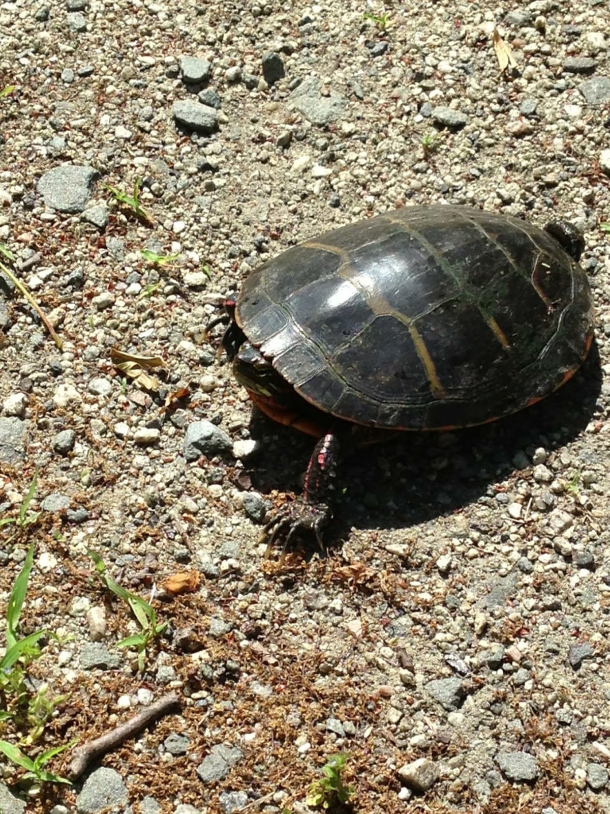
The only exciting sea life we saw on the rest of the dive.

By this time, we'd tried at least 6 directions and hadn't seen anyone.  We'd had 3 charades rematches and I'd screamed into my regulator twice.  We were low on air and had no other option other than to just come up where we were.  So now, not only am I having the 'I'm lost' freakout, I'm also having the 'I'm going to look like a dumb tourist' freakout.  I hate looking like I don't really know how to dive competently, mostly because it's partially true.  We only go once a year, so I'm in a constant state of trying to remember how to not die while doing it.  So now I'm dumb blond diver.  Great. 

We're floating in open water during our safety stop and suddenly I see movement.  Glory hallelujah it's another diver! I grab mike and start swimming towards them.  I  see the bow line from the boat and the rope going to ladder.  I remember thinking that the weight that holds it in place looked a little different but in my elation at not looking like a lost moron I didn't even think about it.  I reached the ladder and luckily Mike was behind me since I bolted away and left him at the safety stop (Rule No. 1 - Dont leave your buddy (oops)).  I grab the arm reaching out to help me onto the boat and look up at - a complete stranger.  No wonder the weight looked different - I am on the wrong fucking boat.   

Luckily this apparently happens more than you'd think.  There are multiple tie out point at one dive site and people come up the wrong line.  We actually had to do some sort of hostage exchange because 4 of their divers came up to our boat.  And in the end, the dive crew didn't even make me feel like an idiot which was a bonus.  I also learned that Mike has no fear of being lost and his listening skills need work.  

I couldn't post this without a shout out to Lost Reef Adventures in Key West.  We dove with them all week and they didn't once make me feel dumb even though I repeatedly did really dumb things - including wrapping a tattoo in saran wrap for every dive and once forgetting to attach my BCD to my air tank and almost drowning (not really).  But those stories of stupidity are for another day.

Tuesday, April 30, 2013

Everytrail Review


I tried out the Everytrail hiking app for this portion of the hike.   It worked way better than the app I was using before.  It did have a little glitch about 12 miles in, but the wonderful thing about this app is that it links up with the Everytrail website afterwards, and I can go back and edit out the random 5 mile long triangle through the Hudson River that my phone was so convinced that I took.  It also lets you post geotagged pictures, waypoints, and tell the story of the hike if you're into that sort of thing.  When you post your hike, there are private and public settings so other people can use the trail you mapped.  A search option lets you check out other maps in the area created by users.  So yeah, pretty good app especially considering it's free-ness.

Section 2: 19.3 Miles down

So I said to Mike on Friday, "I think I want to challenge myself this weekend.  Let's do 19 miles".  Mike says "You're an idiot and this is a bad idea."

2 days later, we have parked one car at the NY/NJ state line, and the other car 19 miles down the road, because Mike's a good husband and lets me make my own mistakes - plus I think he really enjoys saying I told you so.  The beginning section of the hike was great.  Not too hilly, passing in and out of some small parks.  One of the big things I noticed were all the downed trees caused by the hurricanes over the past two years.  They have really kept the trail volunteers busy.


So after hiking through Tallman Mountain State Park and seeing some really nice views of the marsh, you hit one of the road hike sections of the trail.  There are quite a few, normally not that long, that link parks together.  They aren't so bad - they give you a section to not worry about tripping over all the godforsaken rocks on the ground, plus it gives you a chance to see all the beautiful lawn decorations people have adorned their yards with, such as this one.


Yes, it is every bit as ridiculously large as it looks. 

Once we finally cut back into the woods, we approached Rockland Cemetery.  This part of the trail is kind of confusing and we ended up going in a big circle and found ourselves back at the damn elephant and had to do the whole part again.  I also discovered the I dropped one of the maps at this point.  Double frick.  Finally back on track, the walk through the cemetery was actually kind of cool.  Lots of big monuments and such.  


Monument for Henry Honychurch Gorringe, brought Cleopatra's Needle from Egypt

After this point, we passed through two more parks and saw some really amazing views of the Tappan Zee Bridge.  After a fair amount of ups and downs, we walk back into town and cross a freeway overpass over 287 - marking the halfway point.  I started thinking "Wow...we still have 9 miles left..." but I was still at this point (naively) optimistic.  

Fast forward an hour, and we are in a road walk spot and Mike tells me his achilles really hurts.  Mike doesn't normally *ever* complain about being tired or in pain during a hike.  And I think he REALLY wanted my to be the first to crack since it was my asshat idea to do this long of a hike.  So now I feel awful because if he is mentioning it, it really hurts.  The trail through Hook Mountain Park was 6 miles but it felt like eleventy jillion.  I didn't take many pictures by this time because the sheer thought of pulling out my phone and having google maps show that freaking blue dot so far from the car made me want to die.  So much so that I took a picture of the random creepy cemetery because at one point I thought I might die of exhaustion or thigh cramps.  


By the time we have a mile or two left, I am literally stumbling down the trail.  I probably would have been mistaken for some really really misdirected drunk by anyone watching.  My knees caps felt like they were attempting to detach from my legs and go on strike.  It was heinous.  How the hell do thru hikers do this every freaking day??  When I finally spotted Mike's car through the trees, I stumbled towards it cheering like it was some sort of Mecca, and possibly hugged it at one point.  

Moral of the story - I am a freaking wuss.  324.05 miles left.

It actually was a really pretty hike, and I probably would have enjoyed it more had I not thought I was some sort of hiking superhero when I planned it.


Monday, April 15, 2013

Section 1: 12.85 Miles down

Two weeks ago I started the first leg of my trek of the Long Path (Yes I know I am very late posting about it).  This section ran from the Fort Lee Historical Park to the Lamont-Doherty Earth Observatory almost 13 miles to the north.  We decided that the best way to do this non-loopy route was the bring our bikes, drop them off at the observatory, then park at Fort Lee.  At the end of the hike, we'd bike back.

So we park at Fort Lee, which is actually a really cool site with a lot older monuments and such left, such as this watchtower.
After we found the trailhead near the visitor center, we started our walk which actually takes you right out of the park and onto the street for the first half mile or so.  Looking for the aqua blazes on light poles and bridges in the middle of a city was a little strange, but soon we ducked into the woods and started a more hikish hike.

Now if you are a hiking purist that wants to be immersed in nature and forget that the modern world exists, this hike is not for you.  For the majority of it, you are sandwiched between the river and the Jersey Turnpike and very rarely out of traffic noise range.  That being said, it really is a nice hike with a lot of beautiful views of the city across the river.
 The GWB at the start of our hike. 
A barge on the Hudson across from what I'm 76% sure is Yonkers. 

The hike was great and you passed through and by a lot of interesting landmarks.  I tried to use my sweet iphone application so I could post techy things like waypoints with pictures, but apparently 99 cents doesn't give you a very, eh...reliable app.  Oh well.

Passing through the woods, you cross many old walls and even a few old buildings.  The most interesting one was right before reaching the Palisades Interstate Park headquarters.  It has no sign or anything explaining it so we took some pictures and moved on, but when I looked it up online later, it actually had a cool story.  It had once been a summer home for a wealthy businessman from the area, and was called Cliffdale Manor.  I found out about it on the Scouting New York blog ran buy a movie location scout.  He has some amazing pictures of what it looked like in its prime.  

The rear of Ciffdale Manor looking into the garage.  

The rest of the hike was pretty much a walk in the woods until at the very end when you started to hit some steeper sections.  One weird part was the fence at the NY/NJ border.  Are they trying to keep Jersey out?  New York in?  I guess we'll never know.  
Yeah, suck it New York.  Husband and I are breaking in.

Now, here's some advice to anyone doing this hike.  After hiking 13 miles, even 13 easy miles, you do not want to get on a bike and ride back.  The ride wouldn't have even been that bad if it wasn't for the 739023754 road bikers that were flying by us every second.  Mike and I have mountain bikes and we're in hiking clothes and apparently we stumbled upon the Tour de France training grounds.  There were so. many. bikers. holy. crap.  All I heard was 'on your left' every 10 seconds for an hour.  Which to my brain sounded like 'on your left fat ass wuss' as they flew past me on the uphills in their spandex on fancy pants road bikes.  So yeah.  I suck at road biking.  Might bring two cars next time instead. 

Sunday, March 24, 2013

How did I get here?


On March 18th, 2013 I turned 27.  Yeah, not that old by most people's standards.  Definitely not old enough to be having some sort of midlife crisis.  I mused that it might be a quarter life crisis but husband reminded me that I probably wont live to be 108 years old.  Great.

While it's no 30, 27 is not a fun age.  My newsfeed is filled with babies. Babies crying. Babies eating. Babies sleeping.  Babies with Santa.  Even naked babies.  Thank god there was no facebook when I was a baby.  Either way, apparently I have reached the baby-making age.  However, I have no desire to participate in the baby-having and baby-raising part of this process.  Yes babies are cute, usually.  They're also loud, sticky, wet, smelly, loud, and whiney.  Yes, loud is in there twice for a reason.  Plus they do not enjoy participating in most of my favorite activities - namely backpacking, scuba diving, and snowboarding.

So as this baby-having pressure bears down on me, I have this (awful) subconscious mantra that when I have kids, my life ends.  No more impromptu backpacking trips for a weekend.  No more week long scuba ventures.  No more Christmas to New Years snowboarding/day drinking trips in Vermont.  Just wipes, bottles, and general household clutter.

So, anyone who has talked to me in the past few months has probably been forced to hear about my obsession with long distance hiking, and more specifically the Appalachian Trail.  There is nothing I want more than to leave all my responsibilities and hike for months on end.  Now, I don't want anyone to think that I have a crappy life and I want to run away.  I am in my first year of a great job as a middle school band director, I have a wonderful husband and a dog who knows the name of all his toys (yeah he's that good).  I just want to get out more and do more before my clock starts ticking, as every uterus bearing woman I've talked to assures me will happen.

That's why I started this blog.  I have decided that 2013 will be year of the Long Path - my first foray into the world of long distance hiking.  The Long Path is a 355 mile footpath through New York, running from the GWB (George Washington Bridge for you non-east-coasters) to a city near Albany, New York.  In order to get the End to Ender's patch, most hikers keep a trail journal as proof they did all the work.  Since it's the 21st century and all, I decided to do it in blog form.

So this is my trail journal.  And my scuba adventures diary.  And perhaps some record of the general shenanigans provided by the middle schoolers I work with every day.  And maybe some dog pictures.  He is pretty much the best.


See? Proof.