Monday, April 13, 2015

Mt. Washington Climb

This March, I was fortunate enough to get another chance at climbing Mt. Washington in the winter. Last February, we planned the trip but NH ended up getting a big blizzard 2 days before.  Long story short, we had to break trail and it made the trek far harder and we hit our turn around time without getting to the top.  This year I was determined to make it.
Mt. Washington

  We drove up on a Monday night, and on Tuesday we did a refresher climb of a smaller peak that looked out over the Presidentials.  It's called 'Imp Face' and I don't know where the name came from but the view is INCREDIBLE.  It's one of the '52 with a View' which are 52 peaks under 4000' with a great view in NH.  Definitely check it out if you're in the Whites.  Here's a panorama.
 They're hard to distinguish, but there's Mt. Madison, Adams, Jefferson, and Washington.

The morning of the climb, we woke up early to get everything ready.  One of my biggest pet peeves is feeling rushed.  Unfortunately, I also highly dislike waking up early.  I think you get where this is going...we woke up a bit late, so we were rushing around to make lunch, fill bottles, get our bags packed with all the gear, and get in the truck.  The bunkhouse didn't have hot water upstairs, so in my hurry I just filled it with the cold tap water rather than going down to the basement (mistake).  Once we had packed up our ridiculous amount of layers, ice axes, trekking poles, crampons, and food, we were off.

Snack break!

It was a pretty chilly day, but when you are doing a strenuous climb the issue is often overheating rather than being cold.  You don't want to sweat because then you have wet layers.  It's a constant cycle of layering up when you stop and then taking them back off before you get going again.  We took the winter route of the Lion Head trail which goes up some really steep terrain which meant ice ax and crampon time.  Well in reality, the whole trail is really goddam steep except a small part after you hit Lion Head.  It's really worth it though.

After treeline, the wind really gets going.

Once you get past tree line, the real fun begins.  I first want to say it is absolutely gorgeous.  I mean it takes your breath away.  Unfortunately, so does the wind.  When we went, it was about 50mph sustained with 65mph gusts.  I had to brace myself with the poles quite a bit.  I know the don't look the coolest, but you really need the trekking poles.  Trust me.  It's brutal but you hike up alongside Tuckerman Ravine and a side peak named Bootspur and it's just amazing. 

Bootspur

The worst part of the climb (in my opinion) was the summit cone.  It is really steep, really rocky and goes on for what feels like an eternity.  The phrase 'embrace the suck' came to mind.  This part was extra crappy, because I was getting horribly dehydrated because my water bottles had both frozen solid thanks to my cut corners that morning.  I should have boiled water, put it in my bottles and then put them inside a wool sock in the center of my bag.  I didn't and I paid for it.  Not drinking made me not want to eat.  By the time we summited, I was running on fumes and felt kind of terrible.

This is what it looks like from Lion Head...not so bad...I can climb that.

However, this is what you see while climbing and it makes you want to cry (but don't because your tears will freeze...)

Once you make it to the auto road, it's just a short climb until you're finally standing victorious at the top.  It really is an awesome feeling to have accomplished such an epic climb, and I was so thankful mother nature let us do it this year.  Unfortunately, many days the summit is socked in by clouds and you can't see these amazing views from the top.  If you can plan the trip around the weather, do - you'll be thankful you did.  We got lucky.  Even with the amazing viz, we still didn't stay on the top long.  It was -30 with the windchill.  We didn't even take off our balaclavas for the pic.


One word of advice tho - if you go in the winter, make sure you are with a guide or someone with equal experience.  There are many areas that pose avalanche risks, as well as the usual dangers of winter hiking like getting lost and freezing to death.  People die in the Whites because of being ill prepared, and not paying attention to (quickly) changing weather conditions.  Make sure you know what you're doing, or are with someone who does.  

Wednesday, June 11, 2014

Camping Solo or: How I Learned to Stop Worrying and Love the Dark

Last weekend I did something I had never done before - I camped alone.  I started toying with the idea because the sections of the Long Path I have left are about an hour and a half away, which is longer than I want to drive twice in one day.  Mike has gotten into a routine where he brews for 5 hours in the morning on Saturday, and golfs on Sunday morning, and I've been having trouble finding other hiking partners that want to do my miles and camp overnight.  That left going solo as my best option.

I did some research on the internet about solo hiking/camping as a woman before I went and this is the advice I gleaned:

    -Camp somewhere you've been before
    -Make sure someone knows where you're going
    -Camp near a family
    -Tell a ranger that you're camping alone and hope he's not a rapist
    -Camp near the ranger and hope he's not a rapist
    -Tell everyone you meet that your boyfriend is just behind you
    -Carry a gun
    -Never carry a gun

Then the comment section is full of ridiculous arguments about how women should never go anywhere alone because if they do they are just looking for trouble.  This is immediately followed by a bunch of outraged women talking about how they yo-yo-ed the AT 4 times alone, unarmed, and naked and never had any problems because the trail is filled with rainbows and unicorns.  The truth is probably somewhere in the middle.

Mostly I learned that most people don't agree on the topic.  Here's my take on it.  You're always going to be a little uncomfortable doing something new on your own.  Most people won't even eat in a restaurant or see a movie alone.  With that being said, it's important to know your comfort level.  The woods is not an inherently scary place for me, and I've done a lot of solo hiking so this was a semi-comfortable next step.  If you've never even hiked alone, camping alone may be a bit of an extreme step.
My bag taking a break

I did follow the advice of picking a familiar trip for my first time out and did make sure Mike knew my route and ETA's (common sense).  I did not bring a gun.  They're heavy and I'm not licensed to carry in NY.  I do always hike with a fairly hefty knife though.  Though I don't go out of my way to lie to random strangers I pass on the trail, I also don't announce that I am camping alone.

I hiked in 15 miles and did a route that was not too hard, but had some great views and lots of water.  I planned out my stops, and picked a route with a bunch of camping options in case something changed.


My hike was nice but uneventful and I arrived at my campsite around 6:30.  Here's where camping by yourself starts to feel different.  All those chores you usually split?  Now it's all you.  It takes a bit longer to get everything done.  It took me about an hour to find a good spot for the hammock (my favorites were taken...), hang it correctly, get the sleeping bag/pad set up, and hang the bear bag.  Most of that time was spent trying to get the hammock even because I was in a bit of a weird spot.


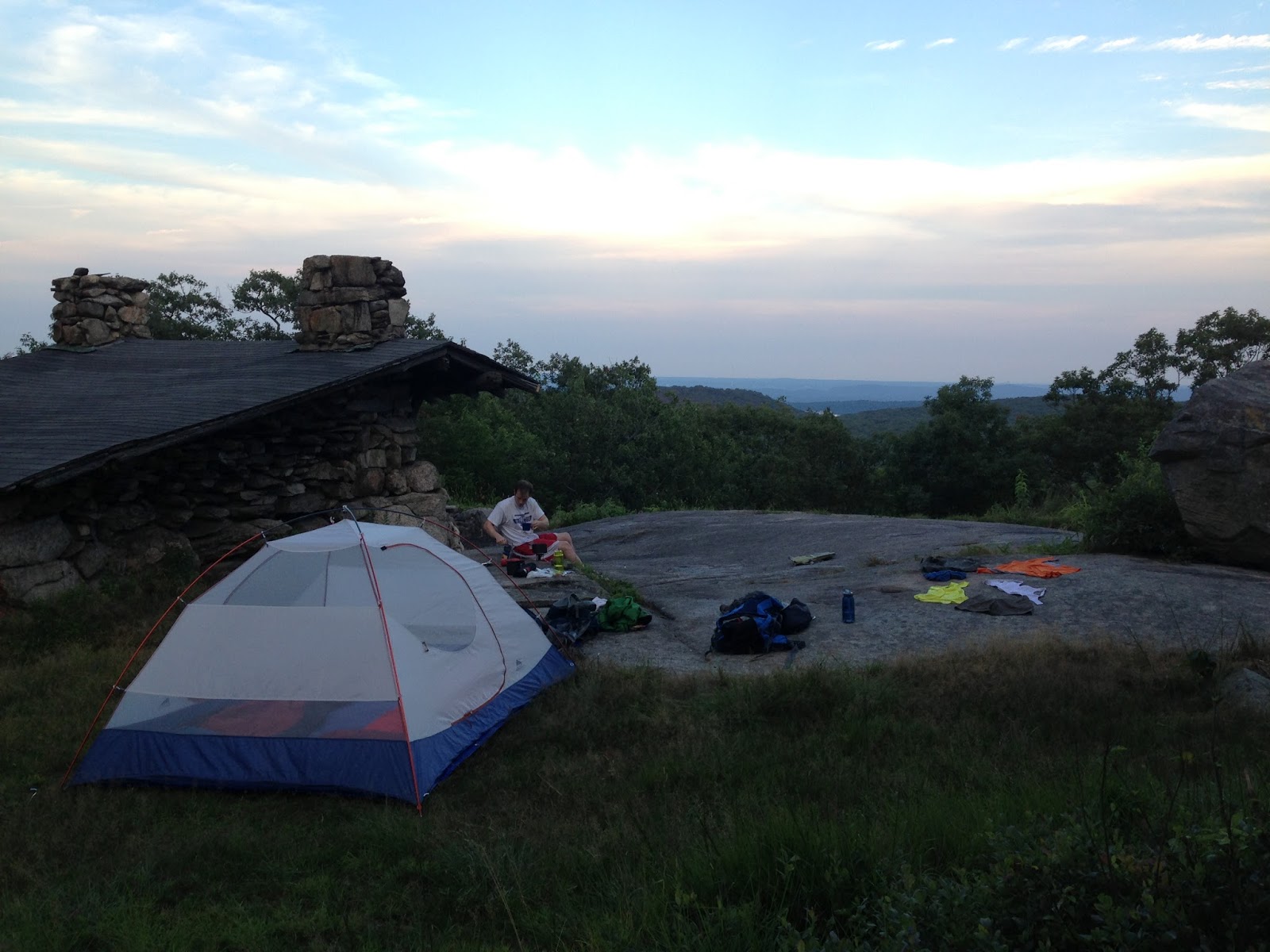
After I got set up I cooked my dinner and sat on my rock to watch the sunset.  In Harriman, you must camp within sight of a shelter so there were 3 other groups near me.  There was a sickeningly romantic couple that took my Hammock spot, and two families with kids.  It was comical to see the contrast between them - one with kids glued to not one but two iPads, and the other with kids playing Uno on the rocks, acting out stories, and climbing on rocks.  You know, actual camping activities.  It was great to see, and they so nicely gave me some bug spray since I forgot mine and looked like PigPen with all the mosquitoes clouding around me.  It was nice to feel like I wasn't completely alone, even though I didn't really talk much to any of the groups.

Dining for One

Night is usually the time that makes people the most anxious.  Camp chores are done, and you're just laying there with your thoughts (and fears).  I found that I'm more nervous in my empty house when my husband's away on business than I was sleeping in the woods.  It's just a happy place for me.  I do have trouble actually sleeping outside whether I'm alone or not.  It's not that I'm afraid, I just can't wind down.  I tend to sleep right away, wake up about 2 hours later, and then lay awake for like 4 more only to doze off around dawn.  I get put on high alert whenever there's a rustle outside which makes for crappy sleep.  For the first time, I brought ear plugs.  They did help a little, but I still was up a lot of the night.  I think I'm just going to start Z-Quil-ing myself to sleep from now on.  

Mostly, I just laid there and basked in the quiet.  As a band director, I spend most of my work days surrounded by copious amounts of noise.  Like honestly, I think I'll be deaf by 40.  Around concert time, I get to the point where I can't even form complete thoughts in my head.  Being out there gives me time to recharge.  Even when I can't sleep, I just soak in the quiet night-noises and revel in lack of drum-banging, clarinet-squeaking, and kid screaming.  (Is it sad that after a really rough day, smelling  that woodsy smell my sleeping bag permanently has a calming effect? (Can someone bottle that so I look less like a weirdo?))

In the morning, I felt the disadvantages of being alone again with all the tear-down and pack up.  Lots to do and no one to share the work with.  I planned it so I had an easy hike out and was soon back at my car.  
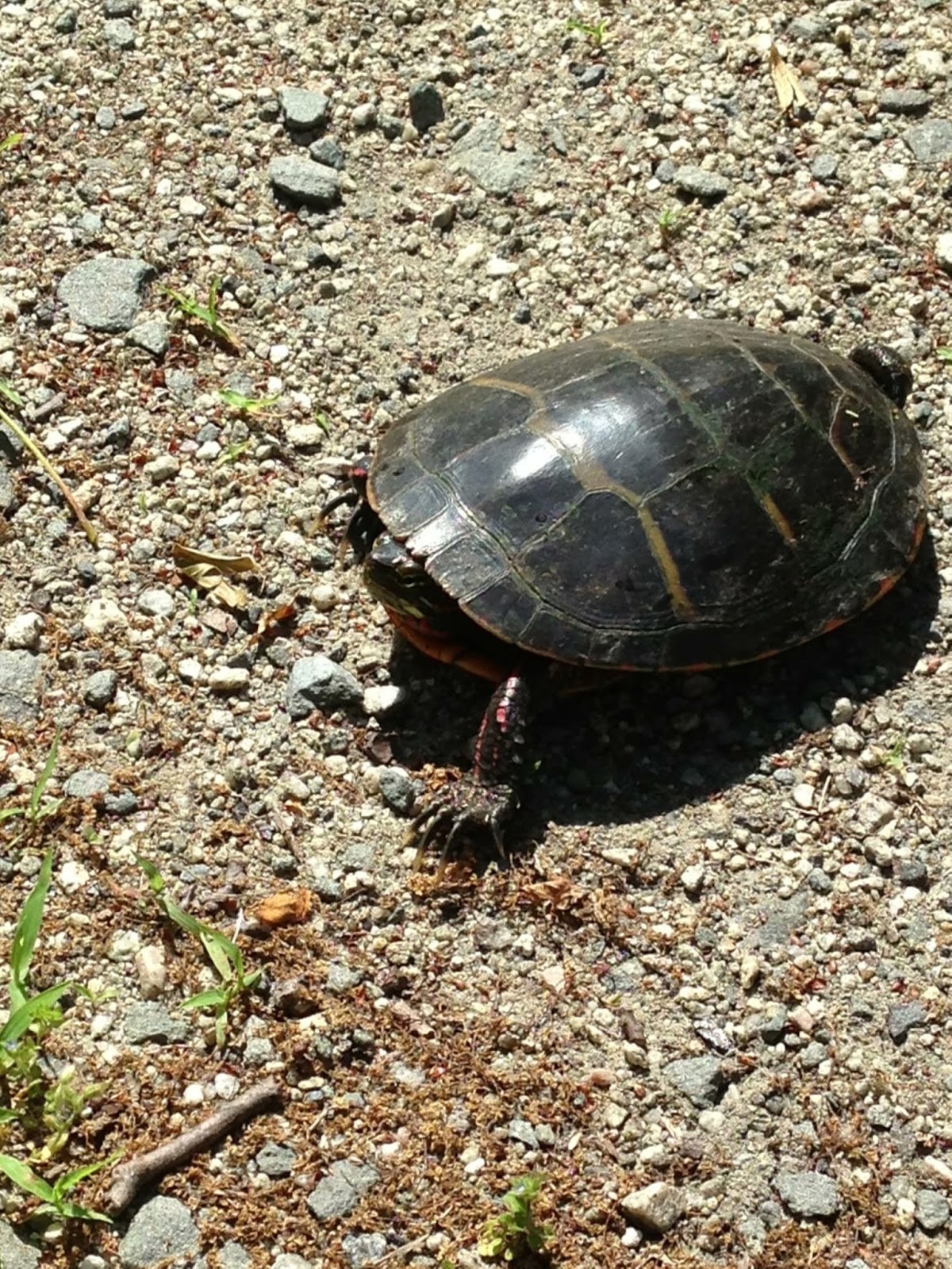
Saw this little guy on the hike out


I'm planning another solo trip soon to actually knock some miles out on the Long Path and I think I'll be ready.  I will probably be alone in camp this time, so we'll see if that changes my feelings about it. I have found that I feel far more comfortable in a high up, open campsite than a more secluded and woody one.  The later makes me feel claustrophobic.  I think that's the most important factor in the whole process - do what makes YOU feel comfortable and you feel happy.  You need to make smart choices of course, but don't shy away from new experiences just because they are not part of the status quo. (Is this where I #Yesallwomen lol) It was a nice, calming experience and I'm excited to go again.

Wednesday, March 26, 2014

Mt. Washington Epic Adventures

Recently I saw a meme that said not to use the word 'epic' unless a sword is involved - I decided that an ice axe counts.

Our first view at the beginning of the hike

The trip started with some...erm...adventures in driving.  What was rain in Connecticut when we left turned into freezing rain in southern Vermont.  The entire freeway was covered in ice, and even thought it was a main highway it was really poorly plowed.  Luckily once we got to New Hampshire, it had turned completely to snow and was much less slippery.  We got in at like 11:15 and signed into the Bunkhouse and got our gear.  

Surprise #1: Mike met our two hiking partners before I did.  "You always seem to find them...no matter where we go" was all he said when I got downstairs.  Turns out they were from Chesterland of all places.  Travel all the way to NH to find people who grew up 20 mins from me.  Who would have thought.  

Coming down!

Day 1 of the trip was a skills class.  We did a gear shakedown in the morning, and then went out and learned how to use crampons and an ice axe in the afternoon.  Our instructor was great, and we were soon duck walking, French stepping, and toe picking all over the small mountain.  I also got to be the object lesson for why you use special steps in campons - catch your feet on each other and you will fall face first down the mountain.  Luckily it was a flat section so I just looked like a moron but didnt get hurt.  Overall, it was really cool learning, and we got to check out some nice views.  Once we were back down it was self-arrest time. Sliding down and stopping on your back feet first - totally fine.  Trying it head first on your stomach and head first on your back - not so easy.  After the trip, we headed back to the Bunkhouse, drank some beer, ate dinner and rested up for the next day's climb.  


Here's where the adventures in driving continue.  We drove to the mountain-the first time we'd driven since arriving.  Remember all that freezing rain?  Yeah our wheel wells were so full of solid ice, we could barely turn.  Part way there, the car started shaking so badly we had to stop and attempt to break it up with the ice axes.  After much picking, stabbing, and scraping, we got enough off that we could drive without the car smelling like burnt rubber.  

The climbing gets steep

The day was so beautiful and the sky was so blue - like kids-coloring-book-unreal blue.  The winds were calm.  It couldn't have been more perfect.  Until we got off the approach trail which had been so nicely packed down by sno-cats.  A Nor'easter had come through a couple days before and dumped snow on the mountain and only a few people had gone before us, so the hiking wasn't easy.  But the day was so gorgeous that it cancelled out the extra effort.  The steep sections of the winter route up Mt. Washington are steep - really steep.  It's actually not open during the summer because you'd just be climbing a rock wall.  The summer route isn't open in the winter because of avalanche risk.  


All the way up the mountain, we kept meeting people coming back - saying they turned around because of deep snow just before treeline.  Eventually we got to the point where only one or two people had come through - and got to break trail through waist-deep snow.  It was exhausting.  Our guide when first making the initial break, and at times we just army crawled over on our bellies because it was just that deep.  At one point I sank in up to my chest when I stepped in a hollow created by buried trees, but we eventually made it to the wind swept area just before the tree line.  Clouds started rolling in as we arrived at treeline, but just light wispy clouds.  We stopped to each lunch and the views were incredible.   

After lunch, we hiked the rest of the way to Lion Head, a rock formation marking the 3/4 point of the journey.  The weather started to change quickly (something Mt. Washington is known for) while we were hiking this leg.  By the time we got up there, the wind had picked up considerably and the summit was completely socked in.  We took a short break here and met a French Canadian couple returning, saying they lost the trail across the Alpine Garden and had to turn back.  

The guys attempting to cross the alpine garden

Lion Head was where our trip ultimately ended.  The winds had picked up to 40-60 mph and the avalanche risk crossing the snow fields was too high after all the fresh snow.  It sucked that we couldn't make the summit, but it was still an amazing experience.  I had so much fun and learned new skills and we will definitely come back next year and try again.  The highest mountain in the northeast beat us this time, but maybe next year it will let me win.  :-)
Mike and I


Friday, September 13, 2013

'Cooba Divin

Well I never made it out to the Long Path last weekend.  Chris was moving out so we spent Saturday moving stuff around the house and Sunday I had the worst hangover in the history of the world...stupid wine.  We did get to do go to the range and go diving so that made up for it.

This was the first time we went to the shooting range in Norwalk and it was great.  The target system is fully automated so you can specify how far away you want it and set it to turn at intervals, and move forward and back if you want a moving target.  I'm having trouble with the .380 - a piece actually fell off and I had to ask someone to help me.  The guys exact quote - "Well at least you didn't bring the gun out with you."  Do people do that?! Dear lord... Other than that it was fun.  Nice to get back out there.

We also made our debut into the cold water diving world.  We went to Rex on Thursday night to pick up our gear.  Up to this point we have never worn anything thicker than a 3mm wetsuit.  Now we're trying to get into a 7mm farmer john and and a 7mm shortie over it.  If you've ever seen "A Christmas Story", you know how I felt.  I was just walking around the dive shop saying 'I can't put my arms down...'.  Either way, got our gear, put it in the car, and went home for the night.

Ready to go!

 Get up next day, drive to Dutch Springs - which is in Bethlehem, PA about two hours away from where we live.  Issue No. 1 - We pay and go down to the parking lot to set up.  As I connect my regulator and turn on the air, it leaks.  A lot.  So we figure out it's the regulator itself, not an o-ring so we have to load up again, drive to a nearby dive shop and have them fix it.  Luckily it was just a leaky hose and didn't cost us any money.  Issue No. 2 - We get back, unload again and set up our gear.  We squeeze into our wetsuits and are now sweating profusely.  As I try to put my weight belt on, I realize the now 14mm of neoprene over my midsection makes me too fat for my goddam belt.  Luckily we have the old fashioned kind that they put the weights on for transport, so Mike gave me his and used the crappy one.  Issue No. 3 - As we're loading up the weight belts with the 24 lbs they told us to use at Rex, a "helpful" lady comes up and tells us she's on her 300th dive and this is way too much weight.  We only need like 12 lbs.  That's what she uses.  So we compromise on 16 lbs each.  Tank up.  Get all the way to the water.  Put on mask and fins and...can't get below the surface because we're too damn light.  Mike took everything off, went back to the car and got us both 8 more lbs.

FINALLY we get to descend and the visibility is awful.  Probably like 8 feet.  The guy who works there says it's normally much better but they've had a lot of rain lately.  Mike and I lost each other twice and had to come up to reconnect, and once we lost the 'attractions' and had to come up to figure out where the hell we were. When you look at the lake from the shore, you think 'Oh it's not that big - how hard can this be? But with such low viz and feeling like an overstuffed sausage - it was tougher than I though.

Dutch Springs Quarry

After coming up for lunch and refilling the tanks, we planned out our second dive.  This time we took the right weight, and had a definitive plan.  They say plan your dive and dive your plan and they're right.  The second dive went great.  We went down to 75' where the water temp was 53 degrees and stayed pretty warm.  The park has a whole bunch of planes, cars, trains, etc. at the bottom to look at so that was kind cool.  I saw some bass, bluegill, trout and koi.

Overall, it's a good place to try out new gear and test your resistance to cooler water.  There's not a ton to look at but it was really nice to get some mid season diving in.  It is a place where you have to know what you're doing, however.  There's no one to guide you, no boat captain to advise you.  YOU are responsible to make sure you stay safe.  As long as you keep that in mind, you're good to go.

Monday, September 9, 2013

P90X: Back to Basics

So anyone who has been around me during the past year and half knows that I've lost about 35 lbs total by doing P90X and Insanity.  And no I'm not a Beachbody coach.  The programs are solid and I hate the gym with a burning passion.  I'm not coordinated and suck at any type of cardio, so when the girl on the treadmill next to me looks like a glistening gazelle I tend to lose my motivation.

Either way, this past summer I ate a lot of delicious food and drank way too much beer and somehow managed to re-find about 15 of those lbs.  So now that I'm back in school and my pants are a bit *ahem* tight, I'm getting back on the wagon and starting up with P90X classic. I've done Classic, Insanity, X/Insanity hybrid, and a few weeks of X2.  P90X is by far my favorite.  It's well rounded and really gets the job done as long as you don't eat like crap.

I did day 1 today and holy moly am I out of shape.  I used to be able to do this with some semblance of competency but today kicked my ass.  Pull up are my arch nemesis and even with the pull up assist bands I can still only get up like 5.  All I kept thinking is 'I remember this being easier...'.

Fries bad! Shakes bad! Cheeseburgers bad! 


Day 1 is in the books, and hopefully by posting on here I'll actually stick to it and it won't end up like 10 or so P7X's that I've done in the past.

Tuesday, September 3, 2013

Section 8: 9.2 Miles

Alright well I finally filled in the holes and have officially hiked the entire "Hudson Palisades" section of the Long Path.  I really thought I'd be farther along by this time and this may be the 2013-14 project instead of just 2013, but I've really enjoyed doing it and am happy that I've gotten this far.

We brought the dog this time - he had a good time and thankfully didn't get any raw spots on his feet.  He also got to try out his new backpack.  It held two water bottles, some snacks, his leash, and his water bowl.  It also rub Riley raw like his last pack which I'm sure he was really grateful for.

Me and Riley at the top of High Knob in our matching gear.  

We hiked North to South, starting at a commuter lot.  The trail heads away from the lot on a short road walk.  Later, it cuts into the woods by a lake and the rest of the trail is off the road.  It's great that the Long Path organizers are working to move it off the roads as much as possible.  There are some cool buildings in Gonzaga Park that are left from when the property was a Jesuit retreat.

The stone wall around the retreat plus some cool old buildings.

Almost the whole trail is co-aligned with the Highlands Trail (light blue) and inside the park, it's also co-aligned with the Jessup Trail (yellow).  This makes for a lot of blazes, and the trail is not always marked with all of them, sometimes just yellow, so it's important to pay attention to where you're going.  The Highlands and Jessup trails split from the Long Path about 3 miles from the Woodbury trail head, so looking for that turn off is key.  The views from the top of High Knob are fantastic.  There are a whole bunch of overlooks in a row.  I do caution that there are some steep climbs and descents getting there.  We had to do some scrambling and had to grab Riley's harness and lift him down at times to keep him from going flying down the side of the mountain.

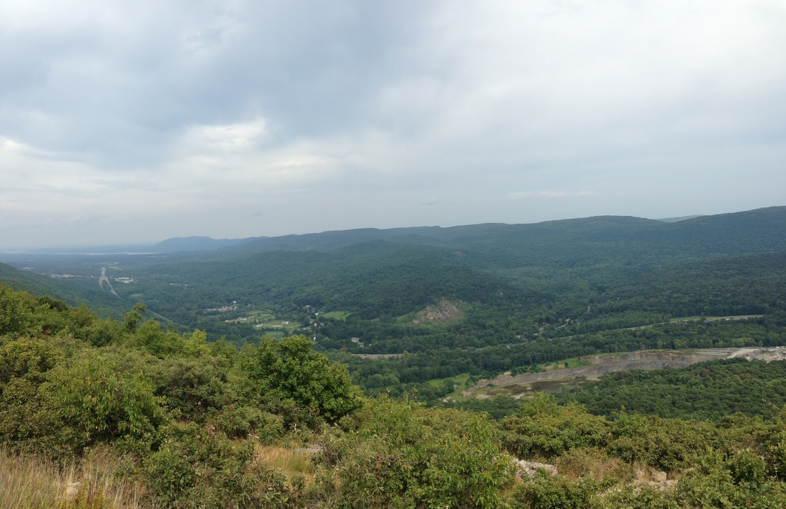
View from High Knob.

Beautiful hike with some great views.  I'm hoping to get up to the Catskills for this (Thank you Rosh Hashanah) 4 day weekend and cross over the 100 mile mark.  :-)

Sunday, July 28, 2013

Section 6: 9.4 Miles

Out for another trip in less than two weeks!  I think that's a record.  I'm always so busy it's hard to fit these overnights in.  It was another out and back which amounted to about 17 or so miles.  We parked at Lake Skannatiti and hiked south towards Mt. Ivy.  The section leading up to the shelter we would later stay in was great.  The Long Path Guide said this whole section was "gentle" so I wasn't surprised.  After the shelter, however, it wasn't so nice.  The next several miles were almost entirely descending, sometimes steeply.  All I could think was "Frick frick frick we have to hike the whole way back before the end of today."


After a few miles, the trail leaves Harriman and enters Letchworth Village Cemetery.  This place was utterly haunting.  It is a cemetery with graves marked only by numbers, because the occupants came from a nearby, now shut down, home for the mentally disabled.  The numbers are very representative of the way people with special needs were treated at the time - committed and then forgotten.  The whole hill had a sad aura around it.


After finishing the section in Cheesecote Mountain Park, the crappy section of the trail starts.  The trail follows the Palisades Parkway for a mile or two in the woods next to the freeway.  We were essentially bushwhacking while following faint blazes.  It was slow going and very tiring.  When we finally arrived at Mt. Ivy, we (thankfully) came out in town and bought some Gatorade from a Shell Station and filled our water bottles in the bathroom. (Yay no filtering!)

For most of the trail, we had pretty much been walking in a veritable cloud of gnats.  They were EVERYWHERE.  I ended up tripping over rocks because it was dim in the woods but if I didn't have my sunglasses on they got stuck in my eyelashes. We decided to take a road walk partway back because of the bushwhacking and the bugs.  We were offered a hitch, but Mike turned it down (much to my chagrin...I hardly thought the family of 4 looked like serial killers).

Big Hill Shelter

When we trudged (that was the only speed I had left at this point) back up to the shelter, we were greeted with a completely empty shelter with beautiful views and no bugs!  It was by far our best camping experience to date.  We could see the NYC skyline in the distance as we ate.  We even got a fireworks show.  (Why there were fireworks on July 27th I'll never know).

Making dinner at the shelter

I was sleeping peacefully until two guys trudged in at midnight, argued about where to camp, cooked food loudly, and ended up sleeping in the shelter.  The shelter's not on the AT or anything...I guess some people just like night hiking...  We woke up at the ungodly hour of 5:30 and were hiking out by 6:15.  Finished the 4 miles to the car by 7:45 and were home by 9am. :-)  Nature sightings - An entire family of turkeys and a coyote.

Section 5: 10.15 Miles

Long Path Section 6 at EveryTrail

EveryTrail - Find the best Hiking in New York

     So the mileage for this route is a little misleading.  I only have progressed 10.15 miles down the long path but this trip ended up being closer to 18 miles between the two days.  We started out at the parking loop on Route 6 and started our hike towards Lake Skannatati.  The plan was to hike out to the lake and then retrace our steps the 4.5 miles back to the Cohasset shelter.  Because of stuff we needed to get done at home, we didn't get on the trail until noon.  The hike out went pretty well.  It wasn't too difficult and there actually wasn't too many steep ups and downs.  We saw some nice views, and some interesting bones on the the side of the trail.  I think they were from a deer.

Some bones chillin' in the trail.

     The second half was actually pretty flat, plus it was well marked.  This section has crossings with many other trails, including the AT so it's really important to pay attention to the blazes.

AT/LT Intersection

     Because of our late start, by the time we got to the parking lot of the lake, it was already 6pm.  We decided to take a shorter route using a road walk, and go to the Fingerboard shelter instead of Cohasset.  By a bit after 7, we got to the shelter and set up our tent.  There were a few AT thru-hikers spending the night but other than that it was pretty empty.

     30 minutes later, a mother showed up with her 8ish year old son, who was shouting out compass directions randomly and tripping over rocks all the way into the site.  He was literally the kid from "Up" personified.  The mom started to set up 10 feet from our tent.  *sigh* I don't dislike kids (obviously, I'm a teacher) but I spend so much time with them and camping is my peace and quiet time.  I don't know the name of the thru hiker who suggested they move to a nice clear spot on the other side of the shelter, but I am forever grateful.

These little guys were all over the trail.  It's a Red-spotted Newt.

     We slept, well I slept and Mike dozed occasionally (he sleeps like crap in tents) and woke up at 6 to hike the few miles out.  Overall, nice trip.  It was also cool to be able to hike on the AT for a bit.  *Someday...*

Tuesday, July 2, 2013

Big Agnes Pearl Sleeping Bag Review


I have been using this bag for about 2 1/2 years and it has served me well during this time.  Most of my trips have been weekend trips instead of long, continued use.  I have used the bag down to 35 degrees, and I was decently warm wearing my thermals to bed.  However, I am a warm sleeper so a cool sleeper might be a bit cold right at the 30 degree rating.  The zipper goes almost to the foot box so it makes for good ventilation for warmer nights.  It does not have a true footbox vent, though.

The fit is nice and loose without being too far from the mummy shape.  I don't feel constrained as I do in most mummy bags - I am a very restless sleeper.  I have the petite version - I am 5'1 so no length issues there.  I can't attest to how it would fit a taller person.  It's really easy to get in and out with the full zip.  

The bag's shell has some moisture resistance but it will wet out pretty quickly if water accumulates at any corner of the tent or seeps in as condensation and the bag does not dry in a hurry.  The bag is down so once the down gets wet, it will lose much of its warmth factor.  If you are spending a lot of time in a wet climate, some of the new drydown options might be better for you.  The bag compresses down really well, especially with a compression sack.  I can get mine down to about the size of a football, maybe a bit smaller.  It takes a little time to puff back up and might need a little coaxing - but I pack mine down REALLY tightly.  

The zipper doesn't seem to have a catching problem and everything works the way it should.  It has a neck baffle that helps keep cold air out of the body of the sleeping bag, but it does not cinch around your face.  It has a little sleeve attached to the bag so you can stuff a fleece or a camp pillow in it and it stays put.  I love it because I can just throw a bunch of random clothes in it to use as a pillow and they stay together.  

The bag has lasted 2 1/2 years and hasn't gotten any rips or tears, and the zipper has held out well.  Remember that Big Agnes bags do not have insulation on the bottom - just a sleeve for a sleeping pad.  It helps cut down on weight and keeps your pad in place if you toss and turn at night.  It is a discontinued bag but can be found in a lot of clearance sales, so it's a great bag for someone looking for a good deal.  

Pros
  • Very light
  • Durable
  • Pillow sleeve
Cons
  • Does not repel water
  • Needs a sleeping pad
  • Cold sleepers may be chilly

Thursday, June 20, 2013

Review of the Keen Targhee II

I've been hiking in these shoes for over a year and I've really like them.  There's virtually no break-in time.  They never gave me blisters and are comfortable even after big miles.  The laces are a little short so if you use custom lacing methods, purchase longer ones.  I do find that really fine gravel sometimes finds it's way in and needs to be emptied which is a little annoying.  This is a low-cut trail shoe, so if you prone to ankle rolling, perhaps the Targhee II Mid's would be better for you.  My ankles are usually pretty stable, so these have worked well for me.

The sole goes up a ways on the sides, which helps keep water out.  They are relatively water resistant when walking through small puddles or mud, but expect to get wet feet if you miss-step during a stream crossing.  They do dry quickly, though.

My favorite part is the toe protection - it is really great when you're worn out at the end of a hike and keep kicking rocks.  The soles are very grippy and are very stable even on steep slopes.  I have been using them for over a year and they have held up very well.  They are well constructed and feel very durable.  Even in chillier weather, they work pretty well.  I've used them in light snow with a good pair of wool socks.  Obviously they won't protect you from deep snow, as they don't be past the ankles.


Pros
  • Protected toe
  • Strong gripping soles
  • Comfortable
Cons
  • Will let deeper water in
  • Little ankle support

Monday, June 17, 2013

Section 5: 11.4 Miles

I'm just doing a quick summary of this section because it there really isn't much to tell about it.  This section of the Long Path follows the Heritage Trail that runs between Monroe, NY and Goshen, NY.  It's a mostly paved rail-trail and is really very nice for biking, running, pushing a stroller etc.  It would be a very nice thing to use if I lived close.  There aren't any exciting views, but its in a pretty area and runs through nice little towns.

I hiked north to south, and then biked back.  The trail starts out as a gravel path.  This first section is pretty rustic and runs through a nature preserve next to a lake.  I saw a family of swans, a heron, turtles, and frogs.
This little guy was crossing the path, and he wasn't a big fan of the paparazzi action.

I wish I could have gotten a better swan picture.  She was sitting on her nest with the dad swimming nearby.  It was so picturesque.  

The trail passed through a town and then restarted, now paved about a mile later.  It was a fairly high traffic trail - lots of bikers and families.  It passed through farmlands, an old railroad parking area with several big pieces of railway machinery, and a very old cemetery.  


 It was up on a hill, a little ways back from the path.  


Ben lived to be 81.  Not bad for 1882.

It was a pretty uneventful hike.  I encountered a woman who claimed she saw a bear and was afraid to walk back to her car.  I walked with her a while, talking to her about how to alert bears to her presence on a trail and how the loud talking or singing would scare them off.  In about 10 minutes she, changed her mind, decided she saw a dog instead and jogged off.  That must have been some dog.  Or a really brave bear.  Or just a really jumpy woman.  

Either way.  Rail trail checked off the list.  I'm starting to get to the areas I can camp in - finally.  Hopefully we'll get some weekend trips and gear reviews going.  I'm also going to do some solo camping trips.  Solo hiking and camping as a woman is kind of a hot topic so I'll share my thoughts.  


Tuesday, May 28, 2013

Section 4: 11.35 Miles

Long Path Section 7 at EveryTrail
EveryTrail - Find the best Hiking in New York

This Monday I embarked on my very first solo Long Path hike.  Mike was at home being an awesome husband and patching the hole in the hallway ceiling, seeding the lawn and being otherwise productive.  I decided I needed to go 'galavanting' through the countryside instead of helping.  I decided to skip the main section in Harriman since it's a perfect overnight and take the section to the north.

At 10am, I have parked my car at the north end of Harriman Park, unloaded my bike, and am starting the the (unfortunate) bike half of my inevitable 'bike and hike'.  The first section of biking was uneventful - maybe even pleasant.  The weather was beautiful, the morning's chill still keeping me cool.  As I biked further, the road started to look more freeway-esque and busier.  The cars seem to be flying by me faster and faster as it transitioned from park road to full blown highway - with nowhere to get off the freaking road.  Becoming increasingly worried about either dying or getting arrested for biking on a highway, I pull off into a small parking area.  My two options are keep going to the road I need to get to by taking an EXIT (now I'm actually on a highway) or turn around and biking uphill back the way I came going the wrong way because now there's a 5 foot tall median separating the lanes.  I chose option 1.  Luckily I did not die (I did get honked at twice) and I arrived at the road to the trailhead and the rest of my ride was pretty uneventful.  After stashing my bike in the woods and locking it to a tree, I walked .2 miles to the trailhead.

I saw two blazes on a guardrail, so I climbed over it and found myself at a river with no way to cross and no further blazes.  It looked like the trail should be here on the map, but it wasn't.  I walked back out the road, followed blazes to the train tressel, but turned around again because the map says it starts on this side.  Long story short, the map was not updated with the new route which caused me to wander around for 10 minutes wondering if my hike was lost before it started.

View from under the train tressel

After a very round about, very overgrown path that lead back under the train tressel, it promptly deposits you on a long woods road.  The road runs between a small brook and a set of train tracks and was very picturesque with wild flowers and mud.  Lots of mud.  It was like walking a squishy tightrope between the tire tracks.  Nonetheless it was quiet and serene.  It gave me some time to work on my macrophotography.  

Some wildflowers.  Not sure what kind.

At the end of the woods road, I was spit out onto a road.  And the road proceeded to chew me for the next 5 miles.  So. Much. Road walking. It actually wasn't so bad for the most part because the roads were quiet and it was easy to keep up a quick pace.  At end of the road section, it continues onto an abandoned road through a rarely traveled section of Harriman.  It was really interesting to see where the very faded double yellow line fell, and how the road is slowly being retaken by nature.

Abandoned road through Harriman.  It got narrower as it went along.

Finally I enter the woods. On a trail.  Like a real hike.  This is where the chaos started.  Remember my previous entry about how I hate being lost?  Well this section was the worst blazed portion I have hiked so far.  Plus, because it was so infrequently traveled, it was less of a trail and more of a 'Where's Waldo' of finding blazes and following them randomly through the woods.  It was a nightmare.  The constant fear of being lost was exhausting.  I wandered off the trail twice and thought I did at least 5 times that many.  About 3/4s of the way through I arrived at what the guidebook said was a seasonal stream that could be crossed on rocks.  Unfortunately because of the recent rain, this was not the case.  Not exactly a raging river, but I couldn't figure out a way to get across it with dry feet.  I tried upriver, down river, upriver again and finally after wasting 10 minutes trying to pussyfoot my way through it, I resolved to use the patented one-in-one-out method.  One shoe comes off and the other one stays on.  Shod foot walks on rocks, the other in the water.  Worked pretty well, and I continued on my way.  Next river I crossed, I wasn't so lucky.  Foot slipped off the rock and I ended up shin-deep in water. Squish-thump-squish-thump for the next mile or two.  

My not-so-raging river.

As I'm putting on my shoe, I see my worst fear. The bane of all hikers.  A big, fat, tick.  Right on my calf.  This is the first time I have ever been bitten by a tick.  My mind suddenly becomes a blur of tick heads being stuck in my leg lyme disease and I can't think of the best way to get the damn thing out of my leg.  I pull out my phone - no internet.  I tried to call Mike - no reception.  Finally I realize I need to just nut up and pull the damn thing out but I don't have tweezers.  Scissors from my first aid kit had to suffice and I'm 99% sure there isn't any tick left in my leg.  

Other than being arduous and pretty boring, the rest of the hike wasn't too bad.  The farther into Harriman I got, the better blazed it was.  I saw a lizard, which surprised me because I didn't know they lived in this area.  At the top of Long Mountain, I found the memorial to Raymond Torrey.  His "Long Brown Path" column was instrumental in increasing awareness of the Appalachian Trail, the Long Path, and hiking in general.  It also was a beautiful view point and a great way to end the hike.  


Plus I apparently avoided a rattler that was near the side of the trail.  I was sad I didn't get to see it, but knowing me I would have stepped on it so maybe it was for the best.